|
There is no theme for the 2024 Art Show |
Below are some interesting facts about Mortlake and the Western District.
Geology
|
History
|
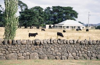
Primary Production
|
|
The Western District consists of a nearly flat volcanic plain created by a number of quite recently active volcanoes, the best known being Mount Eccles, Mount Richmond and Mount Gambier.
Mortlake is situated at the foot of Mount Shadwell, formed 25,000 years ago. It is believed that it last erupted about 5,000 years ago. The large ejected rocks are called volcanic bombs. They are often egg shaped because they cooled as they were being thrown through the air. These bombs can contain olivine, a green crystal also known as peridot, the birthstone for August. Self-proclaimed as the Olivine capital of Australia, it is also known for its bluestone buildings, with several fine examples dating back to the 1850s visible from the Hamilton Highway. Content taken from Wikipedia (2017).
|
The Mortlake area was probably first surveyed by Major Thomas Livingston Mitchell when he passed through the area in 1836–37. The town is based at the foot of a mount, as are many towns across the volcanic plains. The mount, Mount Shadwell, was named after his friend Major Thomas Henry Shadwell Clerke, and the nearby Hopkins River was named after Major John Paul Hopkins.
The first white settlers to arrive in Mortlake were probably David Fisher and his party in 1839, who set up a station which was left under the charge of Thomas Anderson. Establishment of Mortlake as a settlement occurred in the 1850s and 1860s. The Post Office opened 2 February 1859. Many of the original bluestone buildings include those in the Shaw Street Bluestone Precinct, such as the former Mortlake courthouse and the former shire offices. The historic Mill (now privately owned) is located in Mill Street. In the late 1870s, an area of swamp was drained and established as the Mortlake Botanical Gardens, which at its height covered nearly 50 acres. As a present to the township in 1988 (Australia's Bicentennial) a new lake was constructed by the State Government. This lake is now known as Tea Tree Lake. |
Wheat was grown in the drier northern part of the district for some time until more easily managed soils in the Wimmera were developed. Dairying was developed as a major industry in the wetter southern parts during this period, as was the cultivation of potatoes and onions on the best soils.
In the Otway Ranges, forestry became the major industry, especially after the building of the Great Ocean Road which opened up these very wet areas. Tourism is the dominant industry in towns such as Lorne and Apollo Bay. In towns like Heywood and Nelson, pine plantations have been the dominant industry since the 1950s but the industry, even as plantations mature, is under threat due to poor prices. |
Further Reading:
Pastures of Peace: A Tapestry of Mortlake, Shire of Mortlake, 1985
Families of the Mount: The Pioneers of Mortlake and District 1839-1880, Craige Proctor and Florence Charles, 2010
Families of the Mount: The Pioneers of Mortlake and District 1839-1880, Craige Proctor and Florence Charles, 2010
